The Sears Gazetteer contains a list of locations in the USA with the name Sears, compiled by Ray Sears over the years. Also see Alabama, Maine, Mississippi, Alaska, New Mexico, Virginia and others on this site.
Arizona has 5 placemarks. Sears Kay Ranch, Sears Park, Sears Point, Sears Tank, and Sears Trailhead. A few more are listed here.
Just be aware, there are some restrictions when hiking the Sears Trail.
No more than 15 people are allowed to be in a group. No more than 15 head of livestock are allowed in a group.
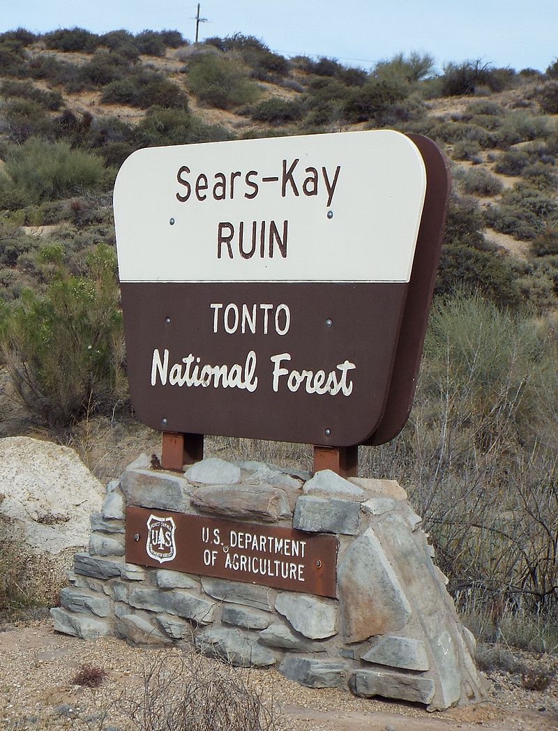
The Sears-Kay Ruins
The Sears-Kay Ruins are located in Cave Creek, northeast of Black Mountain in Tonto National Forest, near Seven Springs, Arizona.
Discovered by soldiers on patrol in 1867, they date back to about 1050. US Soldiers occupied the area during their campaign against the Apache and Yavapai. The ruins of the Hohokam people are now named after the Sears-Kay Ranch. Abandoned around the year 1200, the ruins are composed of about 40 rooms in 5 separate buildings.
A replica of a room in the ruins can be found in the Cave Creek Museum.
There is some speculation by Pioneer Arizona Living History Museum that Perry Mesa was named after William Perry Sears, a son of J.M. Sears.
The Sears Gazetteer contains a list of locations in the USA with the name Sears, compiled by Ray Sears over the years. Also see Alaska, Alabama, Idaho, Maine, Mississippi, New Mexico, Virginia and others on this site.
There are 3 placemarks in the Gazetteer for Nebraska, 4 if you include the 2 Sears Ranch placemarks in Cherry, Nebraska.
Sears Lake
Sears Lake is located in Grant County, Nebraska, near the Village of Hyannis, Ashby, and Duluth.
There isn’t much information on Sears Lake. According to Wikipedia, Hyannis, the village closest to the lake was laid out in 1888 when the Chicago, Burlington and Quincy Railroad was extended to that point. Only 13 years prior to that, the U.S. purchased 11,000 miles of the Sand Hills from the Sioux tribe for $25,000. The remainder of the territory was ceded to the U.S. after years of conflict and bloodshed during the Great Sioux War of 1876.
President Andrew Johnson reserved areas of Nebraska Territory for the Santee Sioux Indians of Crow Creek, Dakota. Special Agent Reuben Sears scoped out the lands around the Missouri River Bluffs in Nebraska, noting the reservations were “some of the most disadvantageous locations” in the state. – S. Rep. No. 4, 55th Cong., 1st Sess. (1897)
The year 1888 was also when Arthur Abbott and his family settled in what was to be Cherry County, just northeast of Hyannis. “The first term of court for the county was held in 1887 at Hyannis and the first case tried was for cattle stealing. At that time, there was but one store in town and no courthouse, so Judge Abbott presided over the trial outdoors.”
Arthur’s son, Christopher, “married Helen Sears whose father was well known for his building construction in the Hyannis area.” according to the web site for the Abbott Ranch, abbot-ranch.com. They were married in 1914.
Christopher Joseph Abbott (1889-1954) was born in Bird City, Cheyenne County, Kansas, according to https://politicalgraveyard.com/geo/NE/masons.html. He was a banker, in the lumber business, and a director of Northwestern Bell Telephone Co. In the 1920’s, Christopher Abbott was the wealthiest man in Nebraska and the largest landowner in the state. His 4 bedroom, 3.5 bathroom “mansion” was built by architect George Beringhof, a contemporary of Frank Lloyd Wright, according to Oldhousedreams.com.
A description of the Abbott Ranch from the October 1978 issue of National Geographic:
From the main highway the road back to the ranch is nine tough miles of ruts and sand traps. The farther you go, the more you wonder where you made the wrong turn. Suddenly, around shoulder of a a high ridge, there is ranch headquarters. The main house, in a grove of cottonwoods and box elders, is 67 years old, high-ceilinged and spacious. Nearby stands the bunkhouse and cookhouse, and set into the side of the ridge is a combination butcher shop, creamery, and commissary that can feed the ranch crew for two months if blizzards close the road.
The Abbott family has seven generations of family members who were ranchers.
Sears Ranch is located in Cherry County, Nebraska, on Packingham Lake Dr near the community of Kennedy and city of Valentine. Sears.com has a few photographs for sale of Homesteaders in Cherry County and around Nebraska. I couldn’t find more details on the ranch, perhaps it was owned by Sherman S. Sears?
Sears School
Sears School is located in Valentine, Nebraska, and is just over 3 miles from the Sears Ranch. Valentine was founded in 1882.
The Sears Gazetteer contains a list of locations in the USA with the name Sears, compiled by Ray Sears over the years. Also see Maine, Mississippi, Alaska, New Mexico, Virginia and others on this site.
There are 6 placemarks in the Gazetteer for Alabama. McEwen Cemetery, Sears Camp, Sears Chapel Methodist Church, Sears Elementary School, and Sears Marina.
Sears Chapel and McEwen Cemetery
The Sears Chapel Methodist Church and McEwen Cemeteries are located on US Hwy 231, 3.7 km (2.3 mi) and about a 3 minute drive north from Rockford Alabama, in Coosa County. There are actually two cemeteries with the same name located across the road from each other, with one purchased at a later date. The congregation was founded in 1859 by the Sears and McEwen families. The present building was constructed in 1895.
John K. McEwen’s family plot in the cemetery might be the most elaborate. A second hobby involved designing and building a family burial lot. In 1897, he marked off a lot forty feet square at Sears Chapel Cemetery. He cut the rock and masoned the high monument which bears the inscription: “Burial Ground of John K. and C. D. McEwen Aug 4, 1897.” He built the coping to designate his lot. The lot has an arched, marble entrance; the walk-way has inscriptions written into it, and among the tombs is a cenotaph to Jesus. McEwen said, “I made it wormproof and waterproof and now I’m trying to live so it will be fireproof.” He often said that the cemetery was constructed better than his house because he expected to be there longer.
The 15-ton white marble arch in his family’s corner of the cemetery was designed by Italian sculptor Cesare Pillade Falconi. Alabama is known for its white marble, and once even had a gas station in Sylacauga called the Marble Castle, made from surplus marble tombstones. The Comer Museum & Arts Center is another amazing marble structure with a spiritual and storied past.
John A. Sears and Tabitha Jane Sears
John A. Sears (1812-1884) was one of the founders of the Sears Chapel, along with the family of his son-in-law George Washington McEwen and his daughter Mary Catherine Sears. Both became Masons. Sears was a millwright, known as the best in the county, and was living in Rockford in the 1860s. His wife was a well-respected midwife. Ronald D. Bridges, George’s great-great-grandson, posted a biography of John, his wife Tabitha Jane Sears and his family to the USGenWeb Archives. In it is mentioned their children Mary Catherine Sears, Elizabeth Francis Sears, Martha Thomas Sears, Tabitha Antoinett Sears. Other families include Owen T. Sears and his wife Elisabeth Rush, Thomas J. Buckner and his wife, Elizabeth’s sister Temperance Rush.
Sears Marina is a marina on Mitchell Lake and Sofkahatchee Creek in Piedmont, Elmore County, Alabama, south of Riddle, Alabama.
Sears Elementary School
Sears Elementary School appears to be an abandoned school in Birmingham, Alabama. Located across from Higgins Cemetery, the school on Google maps has seen much better days. It is one of many abandoned schools in Alabama.
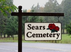
Sears Cemetery
Not in the Gazetteer, the Sears Cemetery in Franklin, Macon County Alabama.
Sears Bluff Road
Sears Bluff Road is located off Highway 9 in Eclectic, Alabama.
The Sears Gazetteer contains a list of locations in the USA with the name Sears, compiled by Ray Sears over the years. Also see Maine, Mississippi, Alaska, New Mexico, Virginia and others on this site.
Montana has 11 placemarks, including the former town of Sears, Montana.
Much of the information below comes from the Montana Memory Project, and “Courage Enough Mon-Dak Family Histories Bi-Centennial Edition”.
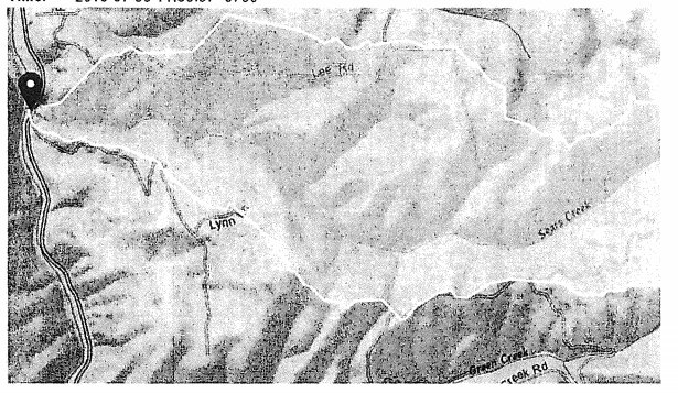
Sears Creek
Sears Creek is located in Richland County, at 47.5502937°N, -104.2654957°W.
Richland County was previously known as Dawson County.
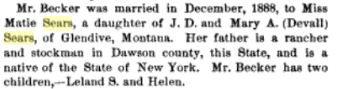
A quote from a quote, “Quoting from the Sidney Herald Centennial Souvenir Edition, 1964, and from the records of Walter Kemmis: “When the Thompson Kemmis family arrived in Glendive, Montana Mr. Meadors met them. While Walter, 14, was following him around town to do some business, they visited Mr. and Mrs. J. D. Sears who had a shoemaker shop. In later years Walter was to know J. D. well, as he ventured into the sheep business in the valley, and Sears Creek was named after him.”
“from an obituary John D. Sears, old-time resident of Glendive, Montana died at Tom’s Creek, Virginia, on December 2. He was 96 years of age. He left Glendive 25 years ago and since then has lived in Virginia. His wife preceded him in death about two years ago. He formerly owned a shoe shop on Merrill Avenue and was one of the early settlers in Glendive. He and his wife were the first two members of the local Methodist Church. He leaves two daughters, Mrs. E. S. Becker of Virginia and Mrs. Gunn of Washington and several grandchildren, among them Harry and John Matthews, formerly of Glendive and Leland Becker who is now in Siberia. – Dawson County Review. Mr. Sears once resided on Sears Creek at Midway, the creek being named after him. He had a sheep ranch at the present site of the Pete Maney farm. Surviving pioneers in Sidney and territory will hark back in memory many years at this news of his death.”
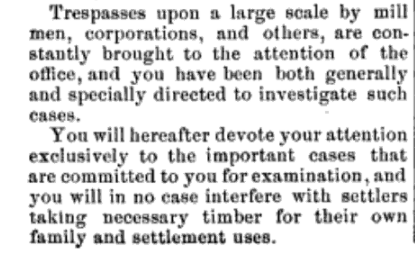
Special Timber Agent Downey of Miles City, Montana was thoroughly chastized when he tried to get Mr. Sears in trouble for cutting down 10 cords of public forest.
The Sears Gazetteer contains a list of locations in the USA with the name Sears, compiled by Ray Sears over the years. Also see Maine, Mississippi, Alaska, New Mexico, Virginia and others on this site.
From 1895 to 1932, the Elk City Wagon Road provided a vital route for wheeled traffic into the rugged Clearwater Mountains in north central Idaho. The Wagon Road linked the gold fields of the upper Clearwater country with established transportation routes to the west. Built roughly along the route of the Southern Nez Perce Trail, the wagon road connected Harpster in the west to Elk City to the east.
Harpster, established in 1897, is the closest town to Sears Creek. Harpster is about 8 1/2 hours from the Canadian border, 3 1/2 hours from Missoula, Montana. The area in and around Harpster includes 2,244 nearby mines
The communities of Stites and Harpster look back upon a history which includes the Nimiipuu (Nez Perce), Lewis and Clark, gold seekers, loggers, cowboys, and homesteaders.
At the turn of the 20th century, Stites and Harpster, the terminus for the railroad and Elk City Wagon Road, provided a transportation hub for the upper Clearwater gold country and Camas Prairie farmers and ranchers.
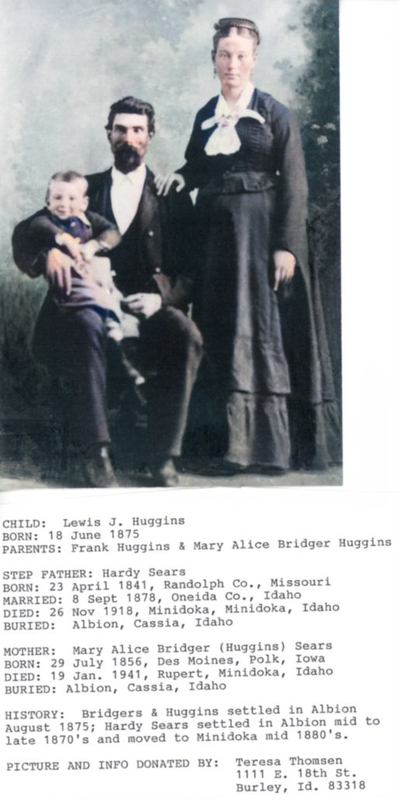
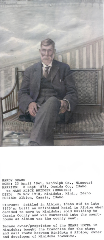
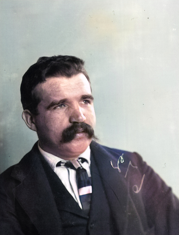
Hardy Sears, born 1841 in Randolph County, Missouri, is mentioned on the Albion Valley Historical Society web site. He settled on a creek, though it wasn’t the Sears Creek…
He served in the Union Army. Mined in Nevada and Montana, raised cattle on the Promentery in Utah. He helped complete the Union Pacific Railroad in Utah and was present when the golden spike was driven in celebration of the event. Minidoka hotel business.
In 1870 Hardy Sears and Dan Stark settled on adjoining pieces of land that could be watered by a creek. Here they built their cabins.
Hardy Sears, Wife and Stepchild Lewis J. Huggins DeOldify
Hardy became the proprietor of the Sears Hotel, which he purchased in 1894 after serving with the confederacy in the Civil War. The hotel was sold and torn down in the late 1950s.
Hardy Sears, later years DeOldify
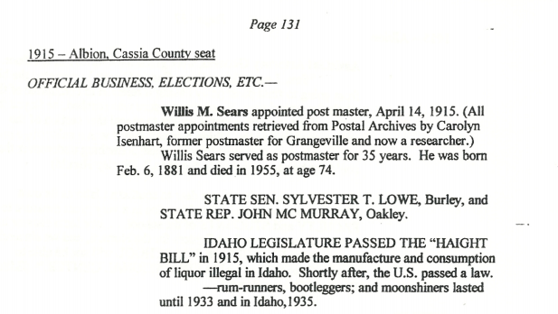
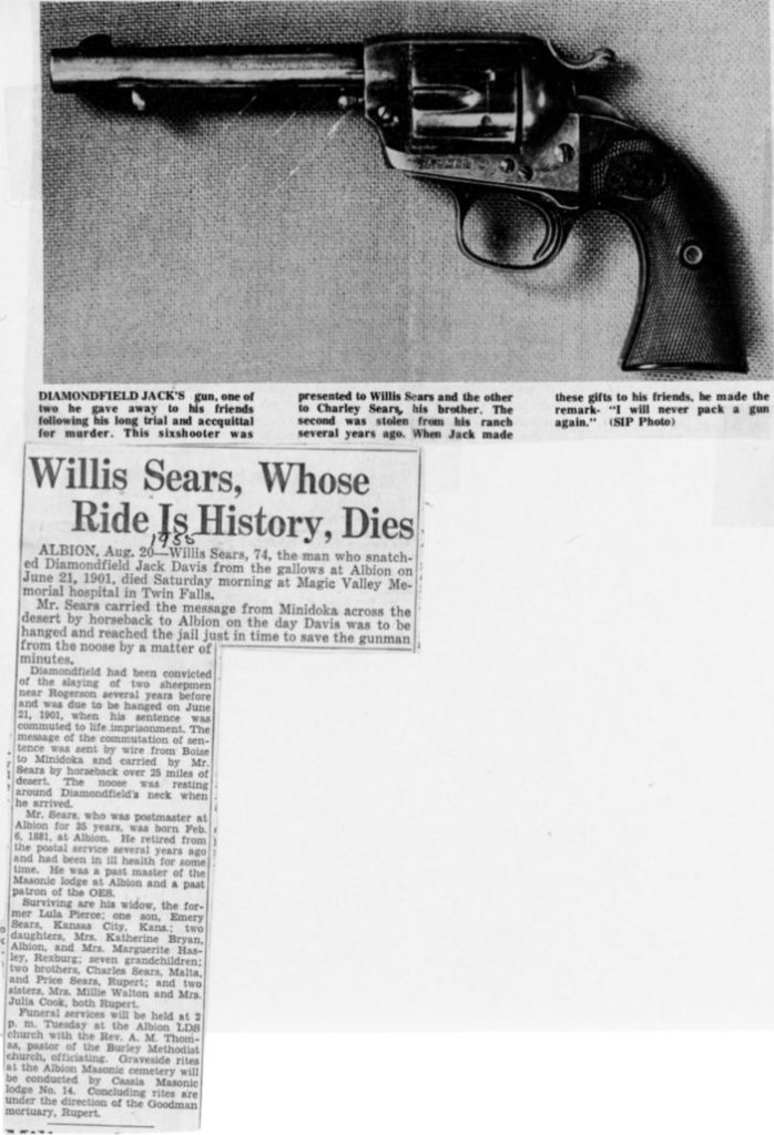
Willis Sears was one of Hardy’s sons. Willis served as a postmaster in Idaho for 35 years.
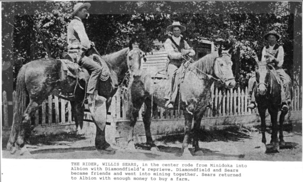
Willis Sears, Albion Postmaster, rode from Minidoka to Albion with Charley Christ in July, 1901, with papers from Boise that commuted the sentence of Diamondfield Jack Davis to life imprisonment. They made the ride on the day Davis was to have been hanged.
Jackson Lee “Diamondfield Jack” Davis was accused of the murders of sheepherders, while patrolling for sheepherders working on cattle land in Idaho.
Diamondfield Jack Deoldify
Diamondfield Jack befriended Sears, and lived quite awhile longer than 1901. His death sentence eventually came to him via a taxi cab in Vegas.
By 1900, Diamondfield Jack had exhausted all of his appeals. He was again scheduled for execution, this time on July 3, 1901. The public was opposed to this and believed Diamondfield Jack to be innocent. Aware of public support from some very influential citizens, the Board of Pardons extended the execution date to July 17. Word arrived in Cassia County three hours before the sheriff would have carried out the execution.
On July 16, 1901, the Board of Pardons commuted Diamondfield Jack’s death sentence to that of life imprisonment. He was again moved to the Idaho State Penitentiary to serve his time.
On December 17, 1902, the Board of Pardons granted Diamondfield Jack a pardon. He moved to Nevada and made a fortune in the Tonopah mining district. He later lost his fortune and was killed in 1949 when he was struck by a taxi cab in Las Vegas, Nevada.
The Sears Gazetteer contains a list of locations in the USA with the name Sears, compiled by Ray Sears over the years. Also see Maine, Mississippi, Alaska, New Mexico, Virginia and others on this site.
Travelling in and around the Oregon Trail, we have 6 placemarks in the Sears Gazetteer for Oregon.
Sears (historical), Locale-Hood River Sears Canyon, Valley-Crook Sears Cemetery, Cemetery-Lane Sears Creek, Stream-Crook Sears Flat, Flat-Lake Sears Lake, Lake-Tillamook
Let’s start with Sears Creek and one that’s not on the list, Sears Road.
Like Idaho, Oregon has a Sears Creek, and a Sears Road which runs over North Fork Getting Creek. Sears Creek is in Crook County, Oregon, between the Ochoco Highway and Marks Creek. Established in 1882, Crook County was named after General George Crook.
Sears Road runs from Row River Rd to Cloverdale Road, a distance of about 10 miles and 13 minutes. Trees, farms, fruit and vegetable stands and houses line the scenic rural drive, sometimes running parallel to the Pacific Highway.
The goats would travel to another Sears location, the Sears Rock Pit, or Sears Quarry off Sears Rd.
Just southeast of Creswell, Oregon on Sears Road is the a castle, built in the last couple decades by the Marquess family. The Creswell Castle is a private residence.
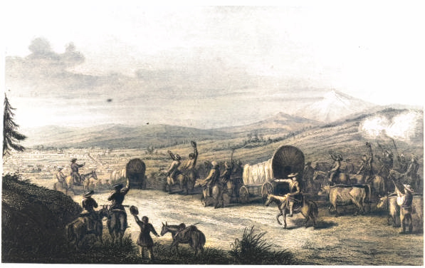
The Creswell Area Historical Society (CAHS)and Museum has some resources for researching early setters and land claims. Kalapuya Indians were living in the area when the first pioneers arrived by wagon train in 1852. Creswell was incorporated in 1909.
Also on Sears Road is the Sears Ranch.
George C. Sears, was the County Assessor of Multnomah county, Oregon, according to An Illustrated History of the State of Oregon, by Rev. H.K. Hines, published 1893. He was born in Richford, Franklin County, Vermont, in 1841. His father was the Hon. Aldin Sears of northern Vermont, his mother was of the Carlton family.
Aldin Sears, George’s father, followed the gold rush west in 1850, building “flumes and quartz mills”. His oldest daughter, Lucy V “came out alone by steamer and the Isthmus, and after his second daughter came in 1851 he founded the first school in Columbia, Tuolumne county. His wife and three sons, including George C. followed in 1852.
George Sears founded a mercantile business called Penniman & Sears, which he ran for about four years, and also purchased lumber claims and built a sawmill, before moving to Santa Cruz. He moved to Portland in 1871 and worked with another partner in the grocery and commission business.
Mr. Sears engaged in the lumber business and later bought an interest in a livery stable on the corner of Second and Washington streets, continuing under the firm name of Sears & Wilmer.
In 1878, Mr. Sears received the nomination of County Assessor upon the Republican ticket and was elected in the June Following, He was re-elected in 1880. In 1882 he became Sheriff, but declined the renomination in 1884, owing to illness in his family.
He married his wife, Jennie Aldrich of RI in 1865. His wife passed in 1885.
In 1884 Mr. Sears began the purchase of property in eastern Oregon for ranch purposes, to which he has added from time to time and owns upward of 4,000 acres, controlling a large range of Government land, which he has stocked with horse and cattle.
Mr. Sears has always proved himself the rigid man for the position, never swerving from the path of duty, but with his characteristic energy and ability and his prompt execution of the law, he has deserved the approbation of all good citizens.
Sears Cemetery
Another placemark in Oregon is the Sears Cemetery at the Cottage Grove Bible Church in Cottage Grove, Oregon. Sears Cemetery contains at least 29 Sears family members, the first buried being Rhoda Sears (1784 – 1861). Her spouse was John Sears (1852-1915).
Jane Carter Sears is the second oldest marker, 1820-1890.
The very presidential Burford/Sears family, the offspring of Hezekiah and Levina (Sears) Burford also settled in Oregon.
Hezekiah (1811-1884): m’d SEARS, Levinia; settled on a DLC in Willamina, Yamhill Co prior to moving to Polk Co and then to Marion Co where he died; founder of Monmouth University, now known as Western Oregon State College; traveled to Oregon with the John E. Murphey train.
His children: Elizabeth A: d/o Hezekiah and Levinia (Sears) Burford George Washington: s/o Hezekiah and Levinia (Sears) Burford James Monroe: s/o Hezekiah and Levinia (Sears) Burford John Milton: s/o Hezekiah and Levinia (Sears) Burford Julia Ann C. (1844-1920): m’d SIMMONS, d/o Hezekiah and Levinia (Sears) Burford Martha E.: d/o Hezekiah and Levinia (Sears) Burford Mary Jane: d/o Hezekiah and Levinia (Sears) Burford Thomas Jefferson: s/o Hezekiah and Levinia (Sears) Burford
BYERLY, Absalom (1833- ): m1. ALLEN, Mary Florence; m2. CROW, Dolly; s/o Martin and Elizabeth (Sears) Byerly; father of 10 children including Henry, Leroy, Arabella, Frank, Otto, Eugene, Edward, William, Maude and Mary BYERLY, Catherine D. ( -1917): m’d BYERLY, Henry; maiden name unknown at this time BYERLY, Henry (1830- ): m’d 1852 [ ] , Catherine D.; s/o Martin and Elizabeth (Sears) Byerly BYERLY, Martin (1810-1893): m’d SEARS, Elizabeth; father of 6 children including Absalom, Henry, Jane, Michael, Jefferson and Adelaide; emigrated with 2 horse carriages, 12 yoke oxen and 3 wagons BYERLY, Michael ( -1852): s/o Martin and Elizabeth (Sears) Byerly; died on trail
Carrol Jackson Sears was married in 1837 to Martha Jane Carter (1820-1890).
From Ray Sears:
This family is from pioneer Carroll Jackson “Jack” Sears (1815-1901) – !BIRTH-MARRIAGE-DEATH-CHILDREN: Letter from Dale Sears, Lilburn, GA; 1784-1852; Letter dtd 25 Jan 1995; ; copy in poss of Ray Sears; In 1837 he moved to Washington co, AR and had all three children. In 1852 he took Jane, three sons and mother to OR via wagon train. The Carroll Jackson Sears homestead is in Cottage Grove, OR. Three Sears brothers that live in Jacksonville, FL own the land.
Also listed, John and Dorcas Sears and their family.
SEARS, Dorcas (c1819- ): m’d c1836 SEARS, John
SEARS, Elizabeth J. (c1837- ): d/o John and Dorcas Sears
SEARS, Frances A. (1843- ): d/o John and Dorcas Sears
SEARS, James B. (c1842- ): s/o John and Dorcas Sears
SEARS, John (c1811- ): m’d c1836 [], Dorcas; family residing in Sacramento, CA by 1850 Census
SEARS, Mary G. (c1840- ): d/o John and Dorcas Sears; m’d bef 1865 LEWIS, George Washington (1842-1922)
The Sears Gazetteer contains a list of locations in the USA with the name Sears, compiled by Ray Sears over the years. Also see Maine, Mississippi, Alaska and others on this site.
The Gazetter has one place listed in Virginia with the name Sears, and it’s in Nelson County, Virginia.
The Sears Lane Trail is an old roadway that General Grant used to bypass confederate troops on his way to Appomattox Court House to discuss the Confederate surrender with General Lee.
Virginia is also home to The Sears Hill Bridge. In 1888, a wooden pedestrian bridge was built to cross the railroad tracks in Staunton, Virginia. An iron replacement was built in 1906. The Sears Hill Bridge connects to the Sears Hill neighborhood and park.
The bridge is famous. There is even a Bridge Day, April 26, in Staunton, or at least there was a couple of years ago. There are some great drawings of the bridge on Kristen Sparenborg Brinton’s blog site, and one was for purchase on her Etsy shop. In 2010 the bridge was condemned, torn down and put into storage. The community rallied around the cause and even put a short film together to raise money to save the bridge.
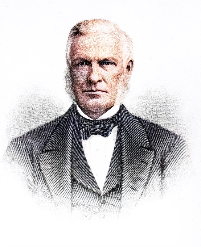
Dr. Barnabus Sears (Wikipedia) Colorized with De’Olidify
Dr. Sears helped edit and contributed to Roget’s Thesaurus of English Words and Phrases in 1859. He also decided that Roget had a bit of a dirty mouth, and, rather than burning Roget’s filthy word book, he would censor it instead. First Amendment and all.
The greatest fault of the work is that of incorporating so many objectionable words and phrases, which ought never to meet the eye or tempt the tongue.
I’m sure he wouldn’t be too kind on the Urban Dictionary…
There is more about Dr. Sears and his legacy at The Historical Marker Database. There is much material to read up on George Peabody, considered to be the father of modern philanthropy.
Making a left turn at Alburquerque and travelling underground about an hour and a half across the border from New Mexico to Colorado, you will end up inside the Sears Number One Mine in San Miguel County. The Sears Number One Mine is just outside of Slick Rock, Colorado, in the Slick Rock Mining District.
Coincidentally, searching for Slick Rock on Amazon results in this thrilling page-turner as the top hit.
What did The Sears No. 1 mine produce? The Sears No. 1 mine produced Uranium and Vanadium.
Searching for the mine on Google presents us with some unrelated litigation via The Colorado Law Reporter, Volume 1. SEARS v. COLLINS, April, 1881 has Collins in court against Sears, his brother-in-law, “to compel a conveyance of the undivided one-half of a mining claim called the Rough and Ready lode. This would have been during the Colorado Silver Boom.
There’s more info on surveys and mining claims in this book.
The Boulder County, Colorado Surveys and Mineral Claims at the General Land Office, 1859-1876: An Annotated Index contains the names of the mine owners (claimant), surveyors and survey crew members, along with the mines and their range and township information. One additional piece of information was added when found—cabins, houses, barns, buildings, bridges, boarding houses, mills, toll roads, wagon roads, creeks and rivers. Using those listings is one way to see what was built where during these early mining days.
Missouri Falls is quite far away from Sears No 1. Mine, and SEARS lost the case, so let’s move on.
CW Sears was a part of Golden Age Mining Company in Lake County. Charles B Sears was a part of Red Park Mining & Water Co in Grand County. JH Sears worked at the Greenback Mine. L Sears (or multiples of such) worked at Fulton, Idaho, and Spar Mine. All of those were in Ouray County.
Clark, Sears & Co ran the Magnolia Mine for awhile, a mine situated 12,198 feet above sea level. Pike’s Peak for comparison, is 14,110 feet.
Pike’s Peak was named after Brigadier General Zebulon Montgomery Pike, who was killed during the Battle of York in the War of 1812 .
Rufus Wainwright wrote a song about Zebulon (well, probably not about General Pike).
Pike’s journals are defined as culturally-significant works which were required reading for all American explorers who followed him in the 19th century. A Pike’s Gazetteer could be put together just on places and things named after him.
The Pike’s Peak Gold Rush, later known as the Colorado Gold Rush, started in 1858 and was one of the greatest gold rushes in North American history.
According to The Diggings.com, Ralph Sears of Grand Junction, Colorado is the owner or former owner of 16 mining claims in San Miguel. All are just north of the Sears Number One Mine.
I haven’t found yet where the name Sears Number One Mine came from, though there are 270 more results for Sears on The Diggings. I can see this being useful research for future posts about the Sears family members who worked the mines for a living.
Travelling east from Sears Number One Mine about another 6 1/2 hours you will end up at Sears Spring in Huerfano County, south of Pueblo, Colorado. Here’s the Sears Spring Topo Map. I didn’t find a lot on Sears Spring.
Another Sears location in Colorado, though not in the Gazetteer, is the Sawyer House / Sears Hotel (Burge Hotel) in Phillips County. The Hotel is on the National and State Register of places, and is located at 230 N. Interocean, Holyoke.
The Burge Hotel was built in 1887. It opened as the Sawyer House and eventually became the Sears Hotel around 1912. In 1926 the name was changed by the new owners to Burge Hotel.
New Mexico has one location on the map, the Sears Well in Colfax County, New Mexico. The Sears well is listed as a cultural feature, located at latitude 36.226, longitude -104.147.
An Aultman photo of Raton Pass in the early 1900’s sangres.com, DeOldify
Lucien Bonaparte Maxwell (1818-1875) owned more than 1.7 million acres of New Mexico and Colorado, and owned the abandoned Fort Sumner.
The below picture shows Lucien, his wife Ana Maria de la Luz Beaubien Maxwell and their 3 children. Their young daughter Verenisa died at age 4.
Maxwell Family Added by S. Butler, FindAGrave.com DeOldifyA young Lucien Maxwell FindAGrave, S. Buller, Jan 20, 2020
Lucien’s only son, Peter (Pedro, Pete) Menard Maxwell (1848-1898) who was general manager at Fort Sumner and witnessed (or ran away from) the killing of Billy The Kid. His sister Paulita would have a relationship with the Kid.
Peter Menard Maxwell Added by S. Buller on 20 Jan 2020, FindAGrave DeOldify
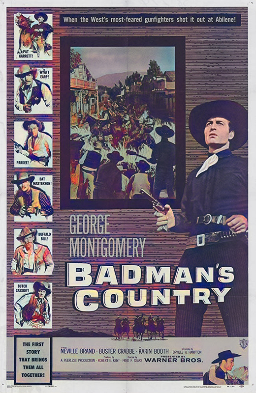
Pat Garrett (George Montgomery) has retired from law enforcement and is on his way to Abilene, Kansas, to meet his sweetheart. He learns that Butch Cassidy (Neville Brand) and his gang are preparing to rob an incoming train carrying half a million dollars, so Garrett calls in Wyatt Earp (Buster Crabbe) and a few other lawmen to move some of Cassidy’s gang they’ve already arrested. When the Abilene locals refuse to stand up to Cassidy and his outlaws, Garrett must take matters into his own hands.
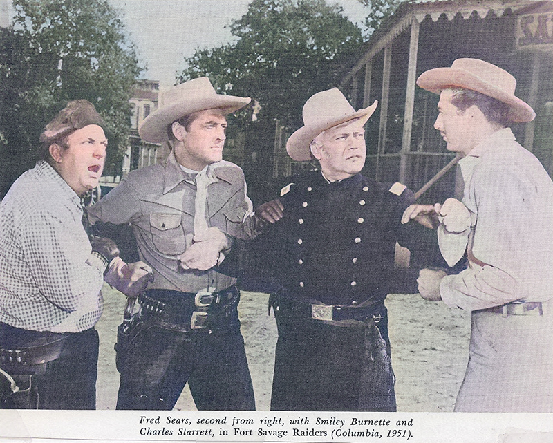
Badman’s Country, IMDB DeOldifyFred F. Sears, IMDB DeOldify
More about Willow Springs. According to the Legends of America Site,
“In the early days of the Santa Fe Trail, a campsite was developed called Willow Springs. Shaded by two big willow trees with a spring that offered a refreshing drink, it was located at the mouth of what would later be called Railroad Canyon.”
The Google Maps Satellite view of Sears Well, New Mexico, shows what looks like a bunch of cattle drinking at the well, and some interesting lines in the landscape centered on the well.
The author continues,
“Sometime during the 1860’s a two-room jacal log house was built at the site. In 1871, it was taken over by a Mr. Sears who removed the old house and built a larger four-room log house that faced the spring. That same year, the land surrounding the house was taken over by a man named John Thacker who established the Willow Springs Ranch with some 700 head of cattle.
By 1874, the owner of Willow Springs Ranch was offering the water for sale to travelers for 25 cents per bucket, at which time, most people postponed their baths and other water needs until cheaper water source could be obtained.”
That’s about $5.64 for a bucket of water in today’s dollars, which is a bit steep even for current rates.
John Thacker, a pioneer from Iowa, came over the pass from Colorado where he had been living, and thought of buying the Sears’ property. He brought seven hundred head of cattle along with him.
That’s about $2.1 million dollars worth of heads of cattle, in today’s dollars. John appears to have been a wealthy cowboy.
Just how many lived there in those first days of occupation cannot be said but in 1871, we learn that a Mr. Sears, known as “Sears at the Springs,” had been living at the spot in a jacal log house which it is said had only two rooms. He was not the first occupant; someone had lived there before him as early as the 1860’s.
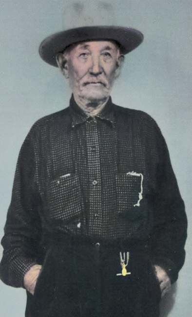
Andrew ‘Pecos’ William Sears (1868-1946) is buried in Clayton, Union County, New Mexico, USA. According to The Union County Leader, August 29, 1946 on Find A Grave Web Site, “Pecos” Sears did not originate from the Pecos river. He was a native of the White Mountains country and Mescalero Indian reservation and came to this country in the early 1890’s with a Bar W, Carrizono Cattle Company herd for shipment and remained here the rest of his life.
Andrew “Pecos” William Sears Findagrave.com Colorized with DeOldify
In 1942, Fort Greely was established near Fairbanks. The Alaska Highway was built in WWII to connect Dawson Creek, BC to the Richardson Highway in Alaska. The Public Roads Administration (PRA) divided the highway into six-lettered sections of several hundred miles each south from Alaska for administrative purposes.
Fort Greely was named after Adolphus Washington Greely, polar explorer and Civil War veteran.
In 1861, First Lieutenant Greely was given command of the Lady Franklin Bay Expedition on the ship Proteus, for an ill-fated expedition to Alaska. Of the 25-man crew who left with him, only 6 survived.
Dot Lake used to be called Sears City, according to the Village history. Sears City isn’t in the Sears Gazetteer. During construction of the Alaska Highway in 1942-43, a work camp occupied Dot Lake’s present location. Upon completion of this section of the highway the camp was abandoned and the structures left in place.
Perhaps the Sears City work camp was run by the Sears Construction Company, who had a contract to build there from 1942-1944. The William Herbert Newlove photographs and postcards at UAA/APU Consortium Library may tell a story. The Sears Construction company was a subcontractor of Lytle & Green Construction Co. Group, of Des Moines Iowa, and mentioned frequently with Duesenberg, both out of Clear Lake, Iowa.
Clear Lake, Iowa is about 52 hours and 3000 miles from Sears Creek, Alaska. It probably took twice as long to get there in 1942.
Here’s a video I DeOldif’ied of the building of the Highway of Alaska.
According to the ALCAN Highway web site, Dot Lake is Mile 1361 of the Alaska Highway. Mile 1938 and parts of the highway were constructed by Sears Construction Co., who were paid at least $560k in 1945 US dollars for their work.
William W. Sears was born 25 Dec 1857 in Cascade, Michigan. According to Samuel P. May, “he is an extensive farmer, and stock-raiser in Alaska, Michigan, and had no children” when Samuel was writing his book. Since this post is about Alaska the state and unlike Kansas City, Alaska the city isn’t in Alaska the state, Farmer Bill will have to wait another day and perhaps another Superbowl for further research.
The Alaska Yukon Gold Book, 1930, mentions the passing of Frank Sears in its records, at the Pioneer’s Home in Sitka, Alaska.
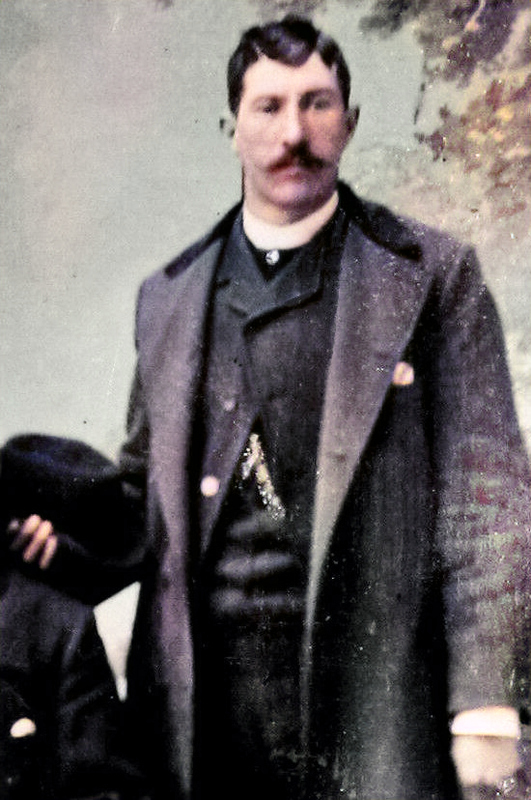
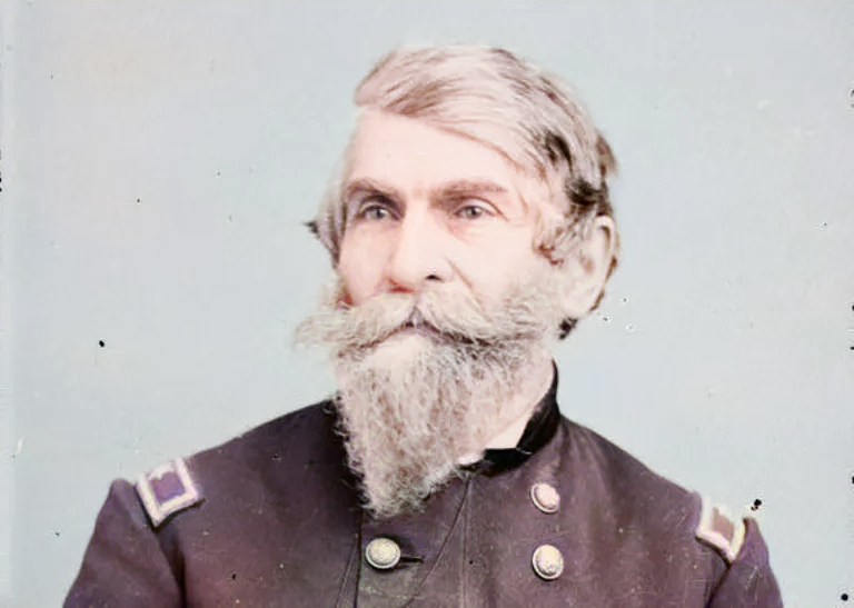
James Hamilton Sears (1855-1915) was born in Binghamton, NY and had some “interesting and adventurous experiences in Alaska” mentioned in Samuel P. May’s handwritten notes below.
Lieutenant James Hamilton Sears, was born and educated in Binghamton, NY; entered Annapolis Naval School, 20 Sep 1871, and graduated with the rank of Ensign, 20 Jun 1876. For three years he was a “Middy” or as now called, Ensign on the Tennessee, which guarded American interests at China, Japan and Siam. Returning from the three years cruise he entered the Naval Observatory at Washington, where he spent a year or more. He was subsequently attached to the Kearsarge as Ensign.
His next detachment was at the navy yard at Charleston, from where he secured an appointment under Captain Schley at that time in command of the Baltimore. This latter detachment brought Lt Sears into the midst of events that have a place in the history of the United States. The Baltimore conveyed the remains of Ericson, the famous inventor, to his birthplace, Sweden. This service performed, the Baltimore sailed to the Mediterranean where after a short stay, the cruiser was ordered to Chili, where hostilities had broken out. The attack made on a party of sailors from the Baltimore, and the tragic death of a number of American naval men is a matter of history. Some of the sailors from the Baltimore were taken prisoners and Lt Sears was sent on shore to secure their release. This dangerous errand was successfully performed, by him and his men, although he was compelled to spend several days in jial. The Chilian incident closed, the Baltimore returned to the United States.
Lt Sears was ordered to Alaska to make a government survey. After interesting and adventurous experiences in Alaska, he was placed in command of the survey boat McArthur, which patrolled the Pacific coast in the vicinity of the bay of San Francisco. Lt Sears prepared a complete history of the Chilian incident which was published by the government.
His thorough knowledge of naval matters as well as his intelligence and ability to express himself, brought him in to demand by the government, as a lecturer on naval craft defense in the Naval College at Newport. From there he went to the Naval Home at Philadelphia, where his stay was abruptly terminated by the trouble with Spain. While at Philadelphia Lt Sears was honored by Capt Schley, who had been given command of the Flying Squadron. In selecting his officers, Capt Schley did not forget his associates on the Baltimore, men he knew to be brave, fearless and trustworthy. Lt Sears was one of these, and to him fell the position of Flag lieutenant. It has been proven an important position, but Lt Sears has been equal to it, and has brought honor to himself and his country.


![By Burlington & Missouri River Railroad Co.
Library of Congress Printed Ephemera Collection;
Portfolio 134, Folder 13.[1], Public Domain,
https://commons.wikimedia.org/w/index.php?curid=4444458](https://blog.searsr.com/wp-content/uploads/2021/08/803px-Iowa_and_Nebraska_lands10-761x1024.jpg)